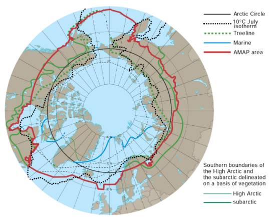
| There exist many different
definitions of the Arctic, based on physical-geographical
characteristics or on political and administrative
considerations within different countries. No simple
delineation of the Arctic region is applicable for
the purposes of the AMAP assessment work.
In order to establish a geographical
context for its assessments AMAP has defined a regional
extent based on a compromise among various definitions.
The 'AMAP area' essentially includes the terrestrial
and marine areas north of the Arctic Circle (66°32N),
and north of 62°N in Asia and 60°N in North America,
modified to include the marine areas north of the
Aleutian chain, Hudson Bay, and parts of the North
Atlantic Ocean including the Labrador Sea. |
|
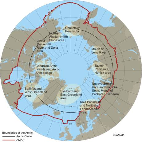
Within the AMAP area, 10 key areas
have been identified that are a special focus for
coordinated and harmonized monitoring and research
activities.
|
|