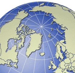
Search the AMAP maps and graphics database by region

All maps and graphics in the database are marked with the approximate geographic region, or country, that they cover, and searching by spatial extent is one way of searching the database. For searching by free text keyword, see the bar to the left, or browse by collection.
- Alaska
- Arctic
- Arctic - High Arctic
- Arctic Ocean
- Barents Sea
- Beaufort Sea
- Bering Sea
- Canada
- Canada - Arctic
- Canada - Arctic Islands/Archipelago
- Europe
- Fennoscandia
- Finland
- Global
- Greenland
- Greenland Sea
- Hudson Bay
- Iceland
- Kara Sea
- Kola Peninsula
- Labrador Sea
- Mackenzie river system (Canada)
- North America
- North Atlantic
- Norway
- Norwegian Sea
- Novaya Zemlya
- Russian Federation
- Svalbard and Jan Mayen
- Sweden
- United States of America
