Turkmenistan
Land
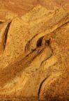 Turkmenistan covers an area of 488,100 sq km (188,500 sq mi), making it the second largest country in Central Asia, after Kazakhstan. The entire central part of the country is occupied by one of the largest sand deserts in the world, the Garagum. About four-fifths of the country is steppe (semiarid grassy plain) that is part of the southern portion of the vast Turan lowland.
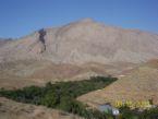 Most of Turkmenistan lies at an elevation of 500 m (1,640 ft) or less. The Akdzhakaya Depression, located in the north central part of the country, is the lowest point in the republic at 110 m (360 ft) below sea level. The Kopetdag mountains, which are prone to violent earthquakes, fringe the Garagum desert along the
 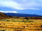 country’s southern border with Iran. Along the
 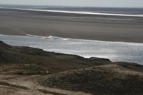 mountain foothills is a belt of oases, which are fed by mountain streams.
Water Resources
Rivers
The Amu Darya, which originates in the mountainous Pamirs region of Tajikistan east of 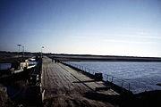 Turkmenistan and forms part of the country’s border with Uzbekistan, and the Murgap, which originates in Afghanistan, are the two largest permanent rivers. Water from the Amu Darya and the Murgap is diverted into the GaragumCanal (built during the Soviet period) to supply water to the arid
  southern portions of Turkmenistan. Other canals divert water from the Amu Darya in the northern part of the country.
Groundwater resources
The renewable groundwater resources are estimated at 3.36 km3/year, of which about 3 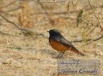 km3/year are estimated to be infiltration from rivers, including surface water resources generated in upstream countries. In 1994, the existing equipment enabled a groundwater abstraction of 1.22 km3/year.
Lakes and Dams
 There are 18 artificial reservoirs with a total capacity of about 2.89 km3: 8 on the Murghab River; 3 on the Tedzhen River; 3 on the Atrek River; and 4 on the Kara Kum Canal. The largest reservoir is the Hauz-Khan Reservoir on the Kara Kum Canal with a total capacity of 0.875 km3. All the reservoirs were been designed and constructed mainly for irrigation purposes, and are affected by heavy siltation.
The gross hydropower potential of the country is estimated at 5.8 gigawatt hours (GWh), while the total installed capacity was about 0.7 GWh in 1993. The construction of the Puli Hatum reservoir on the Tedzhen River on the border between Iran and Turkmenistan has been planned but is awaiting agreement between the two countries. Its total capacity would be 1.3 km3, and it has been designed for flood control, hydropower generation, and flow regulation purposes.
Plants and Animals
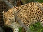
Plant life is sparse in the vast, arid desert, where only drought-resistant grasses and desert scrub grow. The mountain valleys in the south support wild grapevines, fig plants, and ancient forests of wild walnut trees. The mountain slopes are covered with forests of juniper and pistachio trees. Dense thickets called tugai grow along riverbanks. The wildlife in the mountains of Turkmenistan includes the caracal (or Persian lynx), goats, cheetahs, and snow leopards. In the desert, gazelles, foxes, and wildcats thrive. In the tugai live jackals, wild boar, and the rare pink deer. Reptiles are abundant and include the Central Asian cobra, the desert monitor (a large lizard), several species of gecko (a small lizard), and the tortoise. Migratory birds, such as ducks, geese, and swans, inhabit the Caspian shore during winter.
Natural Resources
Turkmenistan has substantial reserves of oil and natural gas in the Caspian Sea area and in the Garagum desert. Other natural resources include deposits of coal, sulfur, magnesium, and salt. Only 5 percent of the country’s total land area is cultivated, nearly all of which (23,000 sq km; 8,880 sq mi) is irrigated.
Document Actions