![]()
Striking the balance - ships and the riverHow do we juggle the need for smart navigation on the Danube to check problems caused by road traffic, while ensuring the protection of the Danube environment against large projects and large ships? |
 |
"How can anyone
justify damaging the river
through more uncoordinated
and unsustainable
navigation projects,
knowing the seriousness
of the damages that
navigation has already
caused?" says Mike
Baltzer of WWF. |
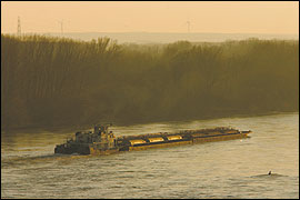
Surely it makes sense to have some boats navigating Danube waters. What would a river be without people eagerly hopping into their kayaks and fishing boats to taste a bit of nature? And why wouldn't tourist boats and barges take advantage of a river that crosses ten European countries, offering access to breathtaking landscapes and new economic markets? But as usual, it's not a question of whether the river should be used for navigation or not. It's about how.
From 1970 to 1999, goods transported by road in the EU climbed from near
500 billion tkm (transport of one tonne over one km) to over 1,300 billion
tkm while rail and inland waterway transport stayed about level. Road and
rail now carry 74% and 14% of all inland freight transport, while inland
waterways account for only 7%. Road has become Europe's favoured transport
option, but the resulting congestion now poses a "serious risk that
Europe will lose economic competitiveness", notes the European Commission's
(EC) 2001 White Paper, European transport policy for 2010: time to decide.
Transport growth from 1985 to 2010 is expected to almost double for goods,
and by 80% for passengers. So the EC's fears are vaild. A friendly alternative,
says the EC, is a shift to inland navigation on Europe's dense network of
over 30,000 km of rivers and canals. Largely underused until now, in part
because of national infrastructure policies, inland waters could be the
way of the future.
Besides relieving Europe's road congestion problem, other benefits are promoted
by the EC. One is energy efficiency - while a ship can move 127 tonnes of
goods over one km using one litre of fuel, rail can only transport 97 and
road 50. An EC study further found navigation more sustainable - socio-economic
costs such as accidents, air and noise pollution, climate change and effects
on the countryside were greatest from road transport with 91.5%, air with
6%, rail with 2%, and inland navigation with a mere 0.5%.
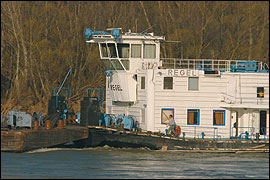
Updating ships and services.
The image of a dirty old coal barge is disappearing. New ships designed
to carry different cargoes have emerged such as the vessel by Dutch firm
Riverhopper capable of transporting 680 pallets while still small enough
to navigate some of the Netherlands' thinnest canals. And the EC is funding
river information services (RIS) such as the Also Danube programme to create
a one-stopshop offering real time traffic information, improved communications
and logistical services tailored to cargo types.
To improve territorial cohesion, boost competitiveness and growth, reduce
congestion and encourage intermodality in the enlarged Europe, the EC developed
its Trans-European Transport Networks (TEN-T) - expected to carry about
half of all freight and passengers in Europe. The Danube, dubbed 'Transport
Corridor Number 7', is a key component and the "backbone of the east–west
waterway connection" which, together with the Rhine, could provide
a key link between the North Sea and Black Sea as well as markets as far
as China.
 |
The European
Commission's
Directorate-
General for Energy
and Transport
supports boosting
transport
on the Danube
River,fearing that
transport in Europe
is going down
the wrong . |
Uncorking the bottle.
Before the Danube can handle more traffic, the EC argues that bottlenecks
- barriers that prevent year-long passage - need to be eliminated. These
include stretches between Vilshofen and Straubing in Germany, Vienna and
Bratislava, Palkovicovo and Mohacs in Hungary, and bottlenecks in Romania
and Bulgaria - nearly the entire stretches of the Danube in the latter three
countries.
To some, eliminating bottlenecks means digging the river deeper at shallow
locations. Since 1998, the minimum depth requirement for the Danube has
been 2.5 metres, a non-obligatory recommendation agreed to by the 11 Danube
countries that signed the 1948 Convention regarding the regime of navigation
on the Danube - the international legal instrument governing Danube navigation,
implemented by the Budapestbased Danube Commission. "The Danube Commission
is always in favour of having the Danube as deep as possible, as long as
no major problems are caused," says Eckhard Schultz-Rauschenbach, Consular
for Public Relations at the Commission, while stressing that this is not
the Commission's official opinion. "If a country plans to deepen a
portion of the Danube, it should be discussed with other countries through
the Commission."
Many public and private companies are keen to help remove the bottlenecks.
The Austrian government agency via donau hopes to improve navigation between
Vienna and Bratislava with EC support. "Eliminating the bottleneck
is a corner stone in Austria's transport policies," says via donau.
Modifications, including deepening of the river to 2.8 metres, would increase
waterway traffic from 12 million to 30 million tonnes by 2015, and up to
one million truck journeys in the Danube corridor would be saved annually,
they say.
More than just a transport corridor.
Not everyone is supportive, however, mainly because of fears of environmental
damage. WWF has been active for years campaigning against changing the river
to the ships and for changing the ships to the river. "The Danube isn't
just a corridor. It's a living river," says WWF Danube-Carpathian Programme
Director Mike Baltzer. WWF found that most of the EC's bottlenecks were
actually the same places as ecologically outstanding areas, some of the
last remaining natural areas along the Danube and many with high levels
of nature protection. According to the EC, over 65% are existing or potential
Natura 2000 sites. Also potentially affected are three national parks, 11
Ramsar sites, one world heritage site, and the last four free-flowing stretches
of the upper Danube.
The findings of the ICPDR's recent Danube River Basin Analysis also fail
to shed positive light on future navigational infrastructure projects for
the Danube. The Analysis notes that to "reduce negative impacts to
the fullest extent", projects "must be subject to" environmental
impact assessments and EU environmental law. The analysis further states
that maintenance of the navigation channel, sluices and harbours has already
had significant negative effects on the aquatic environment. It warns that
an alarming 78%, or 2,170 km, of the Danube River may already have experienced
widespread and permanent changes because of past human uses such as navigation.
The Analysis also says that, because of past changes to the Danube, over
85% of the Danube could risk failing to meet the EU's Water Framework Directive,
its primary water protection legislation, by 2015.
The Danube River Basin District Map 7 (PDF-File, 1.4 MB) depicts the major hydraulic structures
along Danube waterways, including locks and harbours throughout the basin.