SUMMARY
 Rivers
are natural systems that carry water falling on land, to areas lower in
altitude, usually the sea. Energy is lost from the water as it moves from
higher to lower altitudes. This energy allows the water to perform a number
of actions, including the erosion and deposition of sediment. Erosion
occurs when water picks up sediment from the surrounding landscape, the
riverbank or the river bottom. Deposition occurs when water drops sediment
on the river bottom or on the river lowlands during floods.
Rivers
are natural systems that carry water falling on land, to areas lower in
altitude, usually the sea. Energy is lost from the water as it moves from
higher to lower altitudes. This energy allows the water to perform a number
of actions, including the erosion and deposition of sediment. Erosion
occurs when water picks up sediment from the surrounding landscape, the
riverbank or the river bottom. Deposition occurs when water drops sediment
on the river bottom or on the river lowlands during floods.
The erosion-deposition cycle depends on water interacting with different
sizes of particles. The faster the water, the larger the particles it
can carry. When their speed slows down, larger particles can no longer
be carried and are deposited.
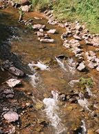
Headwater streams are steep and torrential with alternating pools and
riffles where water flows more rapidly. They are mainly dominated by erosion.
Wood falling from the forest canopy is an important element in the structure
of these streams.
The middle river represents a balance between deposition and erosion.
Much of the heavier material is deposited but lighter silts and sands
can still be picked up by the flow and transported further downstream.
At intermediate slopes, rivers can form braided channels; that is, have
numerous channels separated by islands.
In the lower reaches of the river where the slope of the landscape is
low, sediments are much finer, ranging from sands to fine mud. This zone
is influenced mainly by deposition, but there is also localized erosion
with local reworking of the sediments. Here the main channel or channels
of the river form a sinuous snake-like path across the landscape, that
is refered to as a meander. Individual meander bends are constantly changing
shape because of the processes of erosion and deposition. During the floods,
water rises in the channel until it reaches a level refer to as bankfull
beyond which it overflows the riverbank and begins to spread across the
low-lying floodplain. The floodplain consists of two main components:
• An area of land that is submerged in the wet season and dry in the low water season.
• A number of water bodies (lakes), some of which retain water throughout the year and some of which dry out. These can be small or large.
When water first crosses the bank, the speed of its
current diminishes rapidly, and it deposits the coarser sediments to form
a raised area known as a levee. Levees usually flank the main river channel
but may also be present on the banks of channels feeding the floodplain
water bodies. Levees provide areas that are relatively suitable for human
settlement.
The mouth of the river or estuary is often in the form of a delta with
numerous channels and lagoons. The slowing of current in the coastal flatlands
causes massive deposition of silt. The main channels of the river split
and the river reaches the sea through a number of arms. The various channels
are separated by flat floodplains that are often covered with lakes and
marshes. The lower part of the river has three zones:
• A permanently freshwater zone inhabited by freshwater species;
• A fluctuating middle zone that is sometimes salty and sometimes fresh (depending upon flood and tide conditions). This is inhabited either by freshwater or marine species depending on the time of year. There are also some species that are specialised for living in zones of changing salinity; and
• A permanently salt water zone inhabited by marine animals and plants.
Nutrients are carried by the water from upland to lowland
sections. As they travel they are continually absorbed and released by
animals and plants along the river course. This process
of successive transport and storage is known as "nutrient spiralling"
and is important to ecosystem function and productivity.
Because rainfall is seasonal in most parts of the world, all rivers exists
in two forms, a dry season form where it is confined to its main channel
and a wet season form where it covers adjacent land known as the floodplain.
Flooding of rivers is a natural event that is a very important aspect
of the ecosystem.
Seen from above, a river has a tree like pattern with many small streams
feeding into fewer larger rivers and eventually into one very large river.
The various levels of branching create various levels of streams known
as orders.
The river system includes the main river channels from headwaters to the
sea, and its associated permanent or temporary wetlands including floodplains,
lakes, pools and delta. All of these features are interconnected and inter-dependant.