The Middle River--
The middle river represents a balance between deposition
and erosion. Much of the heavier material is deposited but lighter silts
and sands can still be picked up by the flow and transported further downstream.
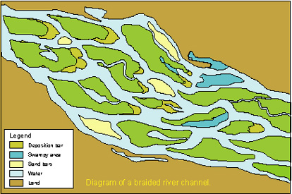
At intermediate slopes, rivers form braided channels. These are places
where the river splits into numerous small smaller channels separated
by islands.
 |
 |
In rivers immediately below mountain ranges the islands
and the riverbed are made up of coarse sediments (cobbles and pebbles)
and are rarely heavily vegetated. Such rivers are highly unstable and
may dry up on the surface during periods of drought while the flow continues
below the surface.
Braided streams of this type are usually inhospitable to fish because
of the mobility of the substrate. They do have many invertebrates and
are a poor source of food. Nevertheless, some species of fish use them
as spawning sites.
The islands are more stable in areas lower down the system. The channel
and the islands are composed of finer sediments ranging from sand to fine
silts. The islands are usually covered with vegetation and may be heavily
forested. They are liable to flooding during periods of high water forming
an internalised floodplain. They do however move and change shape due
to erosion and deposition.
Erosion occurs from the upstream end of the islands as well as from meander
formation and bank under-cutting within the stream channels. Heavy vegetation,
especially forests protects against erosion and slows if not stops the
process. Deposition occurs downstream of the islands as well as on the
inside of meander bends. Emergent aquatic vegetation, such as reeds and
rushes, that is common in shallow water, locally slows flow and increases
the rate of deposition of sediment.
 |
 |
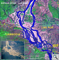
Downstream braided systems form complex habitats for fish:
• There are many types of channel of different depths and strength of current. Some form blind arms or only flow seasonally. During periods of high flow such blind arms form refuges for adult fish and nursery areas for the young. In rivers where floodplains are suppressed they take on an even greater significance as spawning areas and nurseries for some species.
• The major channels may have deep pools that serve as dry season refuges for large species.
• Islands have point bars at their lower, depositional ends that form quiet areas for spawning and as nurseries for young fish.
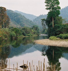
Specialised types of channel occur, usually in the middle
course of the river where the channel is constrained by particular geographical
features such as highlands. Chute and glides form where a narrow stretch
of river is encased between high banks. These have no floodplain and relatively
featureless channels. Current is rapid and fish are generally not abundant.
Waterfalls and major rapids occur where rapid changes in landscape levels
such as escarpments occur. In their extreme form waterfalls and rapids
present impenetrable barriers to movement of fish from downstream to upstream,
at least to the majority of species and may divide the river into two
or more regions having very different fish faunas (faunistic zones).
In areas of low slope the rivers have meandering channels usually flanked
by relatively narrow, fringing floodplains. Local geographic conditions
may allow swamps and extensive flooded areas to be formed, and these sometimes
take the form of internal deltas where the silt from a tributary river
is deposited as a wide fan. The characteristics of rivers of this type
are similar to those of the lowland areas described below.
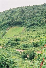
In natural conditions middle order rivers are flanked by riparian forest
that shades the bank zone. However, channels are wide enough for a considerable
amount of light to reach the centre of the stream. Recent human activities
have largely removed the riparian forest along with rivers and replaced
it with agricultural land and human settlements.
![]()
![]()
page 2 of 5