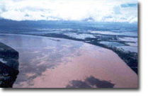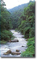
The Mekong River Basin is defined by the land area surrounding all the streams and rivers that flow into the Mekong River. This includes parts of China, Myanmar and Viet Nam, nearly one third of Thailand and most of Cambodia and Lao PDR. With a total land area of 795 000 square kilometres, the Mekong River Basin is nearly the size of France and Germany together. From its headwaters thousands of metres high on the Tibetan Plateau, it flows through six distinct geographical regions, each with characteristic features of elevation, topography and land cover. It would take 2 days of twenty-four hour driving at 100 km per hour to drive the same distance as the length of the Mekong River (4800 km).

The most abundant resources in the Mekong Basin are water and biodiversity. Only the Amazon River Basin has greater diversity of plant and animal life. So much water flows into the mainstream Mekong from the surrounding basin area that, on average, 15,000 cubic meters of water passes by every second. In many parts of the world, that's enough water to supply all the needs of 100,000 people – the population of a large town – for a whole day. This water nourishes large tracts of forest and wetlands which produce building materials, medicines and food, provides habitats for thousands of species of plants and animals and supports an inland capture fishery with an estimated commercial value of US$2 billion dollars per year. Known mineral resources include tin, copper, iron ore, natural gas, potash, gem stones and gold.
Choose a newsletter:
 Top
Top