Informing the process of protecting Mekong livelihoods - the Agriculture, Irrigation and Forestry Programme (AIFP)
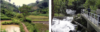
In order to provide a sustainable basis for improving the livelihoods of people on the Mekong, the MRC promotes effective watershed management, improved water-use methods in irrigated agriculture, engagement in research on the best methods for monitoring land-use changes and the baseline studies on watershed management, forestry and land-use planning. Emphasis is placed on community participation in devising culturally appropriate and sustainable watershed management plans and practices. There are two components to the MRC's work in this area: the Watershed Management Component and the Irrigation and Agriculture Component.
Under these two components, five projects are currently underway or recently completed:
- The Watershed Management Project (WSMP);
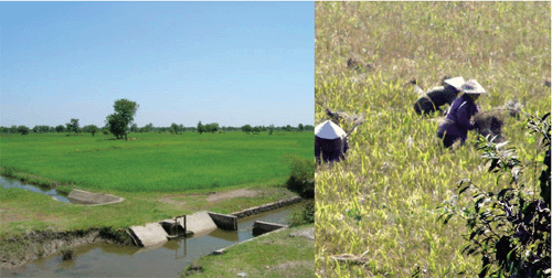
- Demonstration of Multi-functionality on Paddy Fields (DMPF);
- Improvement of Irrigation Efficiency on Paddy Fields (IIEPF);
- Sustainable and Efficient Water-Use in Irrigated Agriculture (SEWU); and
- The Challenge Program on Water and Food (CPWF).
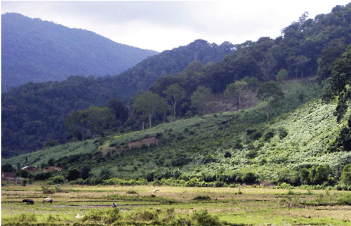
The Watershed Management Project The Watershed Management Project, executed by GTZ, aims to put individuals and communities in charge of protecting watersheds to ensure clean water. Sometimes, this may involve changing agricultural techniques or sanitation habits which contaminate nearby water sources. The programme works closely with the villagers to find solutions to these issues.
The programme ended its second phase in November 2008 and is in the process of beginning a third. The emphasis will change from capacity development in integrated watershed management skills to supporting the implementation of measures to protect watersheds, demonstrating how the approach can be easily replicated in other watersheds by local people.
Demonstration of Multi-Functionality of Paddy Fields Programme This project completed all of its planned activities in 2008. A technical report setting out the project's major outputs, which included an analysis of the multiple functions of paddy fields, an assessment of irrigation water-use in the Lower Mekong Basin and the establishment of a Geographic Information System (GIS) database for rice farming, is being prepared for publication in 2009.
Improvement of Irrigation Efficiency on
Paddy Fields (IIEPF)
This project is also in its final stages. After the completion
of field observations to collect and analyse data relevant to
water balance and water management practices in each Member
Country, four country reports have been compiled. The project
is preparing a report that will outline guidance for efficient
irrigation water-use.
Sustainable and Efficient Water-Use in Irrigated
Agriculture (SEWU)
This new project, which began formulation in 2008, takes up
where the IIEPF left off. It similarly focuses on wateruse efficiency
in irrigated agriculture to promote more efficient practices
and encourage better management in time of drought.
Challenge Programme on Water and Food (CPWF)
The aim of this research programme was to help Mekong communities
and their governments share water equitably and sustainably,
using science-based multi-country basin management in order
to help achieve a balance between biodiversity conservation
and economic progress.
The MRC hosted the programme at the Secretariat in Vientiane and provided managerial assistance.
This phase of the Challenge Programme was effectively completed in 2008. A next phase will be discussed by Member Countries in 2009.
In late 2008, work started on developing an Agricultural Strategy for the MRC to help identify the future role of the organisation in this important sector and to shift from a project to a more programmatic approach.
Mekong River Navigation Information Systems
Projects to improve the information available to the Mekong
navigation industry also progressed throughout the year, including
a regional River Information System (RIS) that will provide
planners, decision makers and waterway users with reliable and
accurate navigation data. In 2008, two tidal stations were established
in conjunction with HYCOS (see page 23) at Cua Tieu (Mekong
Estuary) and Dinh An (Bassac Estuary) in Viet Nam. Shipmasters
and pilots in the estuaries now have access to information on
water levels available in almost real time. This is of particular
importance for larger ships that can only pass the sand bar
at sea during high tide.
Also in 2008, tendering began for the establishment of an Automatic Identification System (AIS) on the Mekong River between Phnom Penh and the border of Cambodia and Viet Nam. This will allow the tracking of vessel movements on this stretch of river resulting in improved efficiency and safer transport.
Support to Line Agencies
Following the establishment of the Navigation Advisory Body
in 2007, four National Navigation Coordinators have been recruited
and are now fully involved in the activities of the programme.
The body had its fourth meeting in Thailand in June 2008.
Regional Cooperation
MRC also carried out activities to promote and coordinate development
of the navigation sector. The first joint seminar with Chinese
Authorities, on Waterway Safety and Navigation Improvement was
held in Jinghong, Yunnan Province, China on 14-16 October 2008.
Another seminar relating to sustainable development of navigation
along the Mekong River is planned for 2009.
Choose a newsletter: