Getting the bigger picture - the Information and Knowledge Management Programme (IKMP)
As the population of the Mekong Basin continues to grow and development places increasing demands on the river system, it is vital that all riparian planners, both in the public and private sectors, have access to data, information and knowledge that is timely, accurate and comprehensive. The MRC works to generate and make available to the public a wide range of information material and services that support development, environmental protection and watershed planning activities. Often, this data is the direct result of research and new and innovative means must be found to display large quantities of information in a way that is user-friendly and easy to understand.
The IKMP is a cross-cutting programme providing data services to other MRC programmes and Member Countries. It helps to manage data, cross-link it and display it to the public and others in the organisation.
In 2008 the Programme was able to catch up on delays that had been experienced in previous years. A number of major implementation contracts were procured. The Programme is now well-set to realise its long-term objectives in 2009, including the implementation of; near real time hydrometeorological data for flood forecasting; access to quality assured and metadata attached datasets; modelling services to other programmes; and upgrading of the website portal and knowledge management implementation.
Hydro-Meteorological Data
Hydro-Meteorological Data comes from a range of sources that
includes a network of stations providing information about the
weather and the level of the river, which is used among other
things for predicting the potential likelihood impact of floods
and droughts.
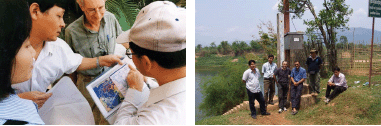
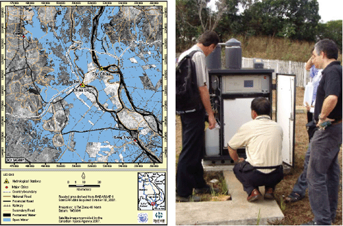
Installation of the automated Hydrological Cycle Observation (HYCOS) network, which measures water levels, rainfall and other climate details on Mekong tributaries, started in 2008 and data from stations is being received and tested for accuracy. There have been efforts to integrate this network into the earlier established Appropriate Hydrological Network Improment Project (AHNIP) network, which carries out the same kind of measurements on the Mekong mainstream - thereby creating one larger Mekong monitoring network. Information from both station networks is fed into the flood forecasting process of the FMMP (see page 14). The data gathered from the monitoring stations has been tested to ensure that it meets quality requirements. A proposal to begin a sediment monitoring project was made in 2008. It is planned that this will be integrated with the present discharge monitoring project and in time, with water quality monitoring.
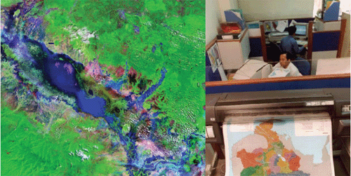
Geographic Information Systems (GIS) and Databases
GIS and database work focuses on the acquisition and display
of spatial data through a broad range of computer tools. This
can be used to map trends and phenomena across the Basin and
is important for a wide variety of applications, including understanding
socio-economic patterns, flood management, and other geographic
trends.
A data and metadata repository constitutes the technical backbone of the IKMP, providing the core services upon which all other components depend. To implement this, in 2008, a "master catalogue" has been set up based on GeoNetwork. This catalogue will contain data and information about the river system that will be accessible by all MRCS staff and other organisations. Work on land-use classification including wetlands has been carried out. Cooperation with the navigation programme was undertaken to produce navigation maps. Modelling of the Kok River in Chiang Rai province of Thailand to strengthen flood management capacity was also completed last year.
Modelling
Computer modelling is used to simulate many natural systems
in the river and to observe how different components (such as
water flow, erosion, sedimentation) are affected. Different
scenarios are engineered and tested to see how the river will
react. Computer modelling is one of the most valuable tools
that the MRC has for predicting among other things, the impacts
of proposed hydropower schemes on the river, heavy rainfall,
drought and climate change.
In 2008, information services to support BDP scenarios were finished and further modelling was planned. Preparation of modelling services related to the environment, fisheries, agriculture and navigation programmes took place in 2008. Comprehensive implementation will take place in 2009. Additional "tools" to the "modelling toolbox" will be added in 2009, including computer models of sediment transport, primary production, deep pools in the Mekong mainstream and socio-economic and environmental impact.
Choose a newsletter: