ISLAMIC REPUBLIC OF IRAN
Land
Iran is the second largest country in the Middle East, after Saudi Arabia. It extends over a total area of 1,648,195 sq km (636,372 sq mi). The country is roughly triangular in shape, with its longest side extending in a slightly outward arc for 2,500 km (1,600 mi) from the border with Turkey in the northwest to the border with Pakistan in the southeast. The third point of the triangle lies in the northeast, about halfway along Iran’s border with Turkmenistan. Iran’s greatest extent from north to south is 1,600 km (1,000 mi) and from east to west is 1,700 km (1,100 mi).
Water Resources
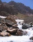
RiversThe country’s only navigable river, the Karun, flows through the city of Ahvaz in the southwest. Most rivers rise in the mountainous regions and drain into the interior basins. Since ancient times, the region’s inhabitants have used the rivers for irrigation. Dams constructed in the 20th century on the Ab-e Dez, Karkheh, Karun, Sefid Rud, and other rivers have expanded the area under irrigation and also have provided a principal source of hydroelectricity. Three rivers form portions of Iran’s international boundaries. The Aras River lies along the border with Armenia and Azerbaijan, the Atrek River borders Turkmenistan, and the Shatt al Arab, also known as the Arvandrud River, is part of the border with Iraq.
Lakes and Dams
Iran shares the Caspian Sea, the world’s largest inland body of water, with four other countries. Several smaller saltwater lakes lie entirely within Iran; the largest is Lake Urmia in the northwest. A few small freshwater lakes exist in high mountain valleys.
Dams have always played an important role in harnessing Iran's precious water reserves and the long-term objective of Iran's water resources development plan is based on the control and regulation of water resources through dams. In 1994, 27 storage dams were in operation with a total regulation capacity of 39.2 km3. At the same time, 24 storage dams were under construction with a design regulation capacity of 11.5 km3. In 1993, the annual electricity production from dams was 25,116 gigawatt hours (GWH), which is 33% of the total energy production of the country. Dams also play an important role in flood control through routing of floods. Several reservoirs behind the dams seem to offer good sailing and water-skiing facilities, but have not been used for recreation so far.Plants and Animals
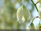
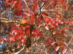
Although more than 10,000 plant species have been identified in Iran, the natural vegetation in most of the country has been uprooted and replaced by cultivated crops or pastures. Natural forests consisting of beech, oak, other deciduous trees, and conifers grow in parts of the Elburz Mountains. Some regions of higher elevation in the Zagros Mountains contain wooded areas consisting primarily of oak. Wild fruit trees, including almond, pear, pomegranate, and walnut, grow in both the Elburz and Zagros mountains. In the more arid central part of the country, wild pistachio and other drought-resistant trees grow in areas that have not been disturbed by human activity. Tamarisk and other salt-tolerant bushes grow along the margins of the Dasht-e Kavir.
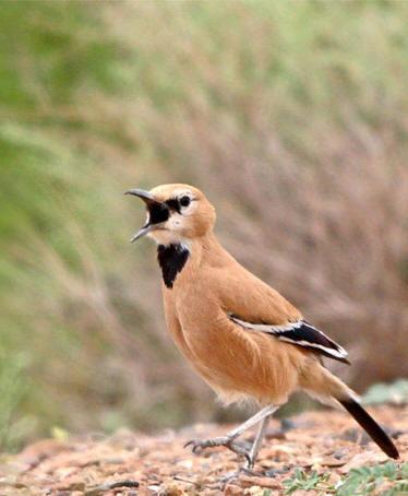
A wide variety of native mammals, reptiles, birds, and insects inhabit Iran. Many species of mammals—including wolves, foxes, bears, mountain goats, red mountain sheep, rabbits, and gerbils—continue to thrive. Others—including Caspian tigers, Caspian seals, desert onagers, three species of deer, gazelles, and lynx—are endangered despite the establishment of special wildlife refuge areas and other government programs initiated to protect them. Some 323 species of birds inhabit Iran; more than 200 species are migratory birds that spend part of the year in other countries.Natural Resources
Iran’s extensive petroleum and natural gas deposits are located primarily in the southwestern province of Khuzestan and in the Persian Gulf. Iran also has one of the world's largest reserves of copper; deposits are located throughout the country, but the major lode lies in the central region between the cities of Yazd and Kerman. This region also serves as a center for the mining of bauxite, coal, iron ore, lead, and zinc. Additional coal mines operate throughout the Elburz Mountains; iron ore mines also exist near Zanjan in the northwest, near Mashhad in the northeast, and on Hormuz Island in the Strait of Hormuz. Iran also has valuable deposits of chromite, gold, manganese, silver, tin, and tungsten, as well as various gemstones, such as amber, agate, lapis lazuli, and turquoise.
Although about one-third of Iran’s total land area is cultivable, only 9.8 percent is under cultivation. An additional 6 percent of the total land is used for pasture. Forested areas, found primarily in the Elburz Mountains and the higher elevations of the Zagros Mountains, have declined slightly in recent decades and account for 6.7 percent of the total land area.


© 2009 CaspEcoProject Management and Coordination Unit
7-th floor, Kazhydromet Building, Orynbor st., Astana, 010000, Republic of Kazakhstan,
Tel. No.: (+7 7172) 798317; 798318; 798320, 798307| E-Mail: MSGP.MEG@undp.org