5. Responses to flood events (cont')
5.2 Specific responses to floods in the member countries
More information on response to flood events is contained in the annexes for each of the LMB countries. A summary is presented below.
5.2.1 Cambodia
In Cambodia, flood management coordination for mitigation and reporting the impacts of floods are the responsibility of the National Committee for Disaster Management (NCDM). At provincial level, a similar multidisciplinary group has been set up. At district level, some of the technical departments are represented in addition to the chiefs of communes. The Communes Disaster Management Committees include the chiefs and responsible members of the villages as well as the "EWS" Volunteers in the villages where an Early Warning System (EWS) has been set up. The United States Office of Foreign Disaster Assistance and the Mekong River Commission signed a Cooperative Agreement on 16th December 2002 entitled, "Provision of Flood Early Warning to Flood- Vulnerable Communities in the Lower Mekong River Basin, Phase 1: Cambodia and Lao PDR". The project is implemented under the overall umbrella of the Flood Management and Mitigation Programme. It started in 2003 in Cambodia in cooperation with the American Red Cross, Action Contre la Faim and the Cambodian Red Cross. The project is also intended to assist flood-at-risk communities to make better use of MRC flood forecasts and warnings, which are issued during the annual flood season.
Limited infrastructure exist in Cambodia for controlling the flood, except some main road sections which have been built on embankments (e.g. National road No 6 ). No regulators or "colmatage" gates are mentioned in the Northern section of the Mekong that could manage/limit the effect of backwater entering into the tributaries. Four control gates (9m wide and 13.5m long) have been built on National Road No 1 from Phnom Penh to Neak Loung (funded by JICA), controlling the backwater from the Mekong to rice cultivated areas.
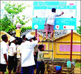
The project "Provision of Flood Early Warning to Flood-Vulnerable Communities in the Lower Mekong River Basin" covers a total of 40 villages. It includes the installation of flood markers and flood alarm noticeboards. Support to the villagers for improving their knowledge on flood early warning and emergency response is also provided. The empowerment of the communities' involvement in the project planning, implementation, and monitoring and reporting is developed at provincial level and Red Cross volunteers assume an influential role in each of the villages.
5.2.2 Lao PDR
Disaster management in general and flood management in particular is the responsibility of the National Disaster Management Organisation (NDMO), which coordinates the technical departments and institutions in charge of facing these issues. At provincial and district levels, similar structures (committees) have also been set up. The committee's members coordinate work in the affected areas in order to assess the damage and primary needs and then proceed to emergency measures, each institution according to its field of responsibility.
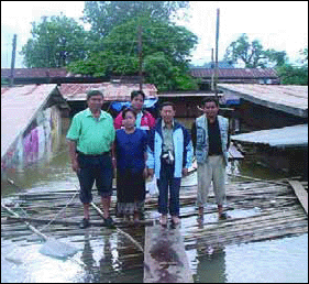
Officials from the social welfare, public security, defence and health departments and the Lao Red Cross work together in the affected areas to help the victims. A quick assessment of needs is done, then emergency aid is provided by the Lao Red Cross staff who proceed to distribution of relief packets of food, clothes, blankets, etc. Social welfare organises shelters where necessary. Health staff are responsible for taking care of the sick or injured and try to prevent disease outbreaks. They run vaccination programmes and recommend people who have red eyes, diarrhoea or symptoms of malaria to seek medical advice immediately. The Department of Agriculture distributes rice seeds for replanting.
Infrastructure for controlling or mitigating the effects of the flood are very limited. Embankment protection along the Mekong or along the major tributaries has only been built in some sections of the major cities. The rural roads are rarely built on embankments in the flood risk areas. Some NGOs have supported village protection efforts such as small embankments for protecting the villages or small dams in suitable land depressions. These infrastructure are often constructed with limited engineering knowledge and at the lowest cost. In case of heavy flood, they may be washed out easily. In some places, the irrigation and drainage canals are also used for improving the drainage of flooded areas.
5.2.3 Thailand
The institutional framework for disaster prevention and management is organised at National and Provincial levels which coordinates all field operations. Specialised Units generally constitute representatives from the Departments of Water Resources, Agriculture and Irrigation, Transport, Natural Resources and Environment, Health as well as from the police service. Losses in agricultural production caused by floods are compensated in cash on a lump sum basis per hectare, and after a declaration by the farmers and an assessment from the relevant agricultural authority.
Except for non-structural measures, a longer term strategy aims to limit the effects of floods by building or reinforcing bank protection. Several regulating structures have been built in Northeast Thailand. Roads along the Mekong River are heightened on embankments which, at the same time, offer efficient protection for land and housing. More and more sections of the bank of the Mekong itself have been protected against erosion, especially in important villages, semi-urban and urban areas. In addition, the protection of urban areas from runoff water is under way.
5.2.4 Viet Nam
In Viet Nam, the need for a coherent, long-term strategy for managing and mitigating floods became obvious following the 2000 flood. Some measures on dealing with emergencies have already been implemented or are under implementation. Some other structural measures are being examined as they require heavy investments and may have questionable long term impacts. The issue of housing located in risk areas is being tackled. Families living in risk areas are being encouraged and supported to move to safer places. Some new settlement areas have been built for these families and some are still in progress or planned. Because rice production is highly important, priority is given to building embankments in the lowest areas, in order to retain the early flood to secure the second rice crop. There is also great pressure from farmers in these low lands to build fully protected areas to enable production of a third annual crop during the flooding period. The flood of 2000 was also a starting point for reinforcement of the road network. The national roads have been raised to a cope with water levels equal to those experienced in the 2000 flood. Rural roads still suffer flooding but improvement of the weakest sections is being carried out and monitored step by step. The road network also constitutes an embankment network protecting the low lands against flood.
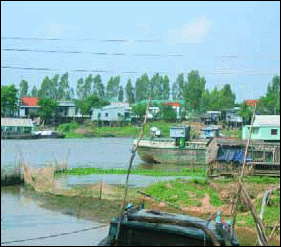
Fish production in Viet Nam is the second most important industry after rice production in the Mekong Delta. Other activities, such as sand dredging, and commercial exchange (navigation) are also essential. Until now industry has been poorly developed, but efforts are being made to attract investors. The delta is characterised by a high density population (over 800 inhabitants/km2 in some districts). Activities will partially, but inexorably, shift gradually from the primary sector (farming and traditional fishing in a natural environment) to industrial and services-oriented activities. This implies development of urbanisation and industrial areas, both of which need to be "fully" flood protected by high embankments, protection against erosion and backfilled lands.
Choose a newsletter: