|
September is usually the month when the monsoon
floods in Southeast Asia reach their peak, and 2006 appears to be
no exception. Following previous acquisitions of wide-swath radar
imagery over the lower Mekong basin in March and in August 2006,
the Canadian RADARSAT-1 satellite captured the flood situation again
along the Tonle Sap and the Mekong on September 21, three weeks
after its previous visit (see Image of the Month Archive). This
month's image consists of a combination of the August and September
RADARSAT-1 imagery, displayed together to visualize most effectively
the difference in the extent of the floods. The resulting "composite"
image reveals a number of interesting details that highlight the
local and regional flood dynamics in a truly colourful fashion.
Using the RADARSAT-1 composite image as a guide,
one can easily see changes between August 28 and September 21, as
they are revealed in the colour scheme. The course of the Mekong,
Tonle Sap and Bassac rivers, as well as other permanent water bodies,
are coloured black; the vast extent of the area flooded on both
August 28 and September 21 is shown by dark blue image tone; the
even greater extent of the September 21 flood situation is shown
by the orange-reddish image tone; and those areas that were flooded
in the August 28 image but not on the September 21 image are shown
in light blue. These light-blue coloured areas are found in the
upland areas and in the floodplain are associated with areas of
rain-fed rice crops.
There are several areas in the lower Mekong basin
where the September flood extent (=reddish tone) has significantly
exceeded the August flood extent. Examples include the eastern fringe
of the Tonle Sap basin and in the southern part of the lower Mekong.
An intricate network of canals and dykes in the south west channels
flood water toward the Gulf of Thailand; in addition, the red image
tones also reveal drainage toward the eastern portion of the Mekong
delta in Viet Nam. Moreover, the reversing flow of the Tonle Sap
River at Phnom Penh is also filling in the basin of the Great Lake
with floodwater.
Actual river gauge measurements, as shown by the flood information
bulletin of the Mekong River Commission (http://ffw.mrcmekong.org/south.htm),
seem to corroborate the interpretation of the RADARSAT–1 imagery.
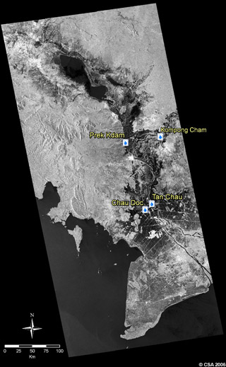
On September 21, the river gauges at Chau Doc and Tan Chau at the
border between Cambodia and Viet Nam recorded levels near the seasonal
high of 3.5 m above the "normal" level of 0 m (= Mean
Sea Level). This situation was similar to that encountered during
the August 28 overpass; during the month of September, much of the
accumulating flood water is draining toward the rice growing areas
to the east and to the west of the main stem of the Mekong and Bassac
rivers. At the Chau Doc and Tan Chau gauges, flood levels have not
reached the crucial danger mark of 4.2 m during this year's flood
season, which suggests that 2006 may be considered a “normal”
flood year in the lower Mekong basin.
Over the past decade, satellite sensors such as
the Landsat Thematic Mapper, MODIS and RADARSAT-1 have become important
sources of information for monitoring land cover and the monsoon
floods in the region (http://www.mrcmekong.org/MfS/index.html).
The Canadian RADARSAT-1 satellite is playing a particularly important
role because of its ability to see through clouds thus revealing
a clear overview of the flood situation as it unfolds on the ground
below. Since 1999, RADARSAT has been used by organisations like
the Mekong River Commission to accurately map the extent of the
annual floods and thus supplement and complement data from river
gauges along the river and flood models.
High resolution jpeg images:
» RADARSAT
28Aug+21Sep flood colour imagery (1.5 MB)
» RADARSAT
flood imagery, acquired on 28 August 2006 (1.3 MB)
» RADARSAT
flood imagery, acquired on 21 September 2006 (1.6 MB)
|