129. Cloudiness map
Cloudiness map

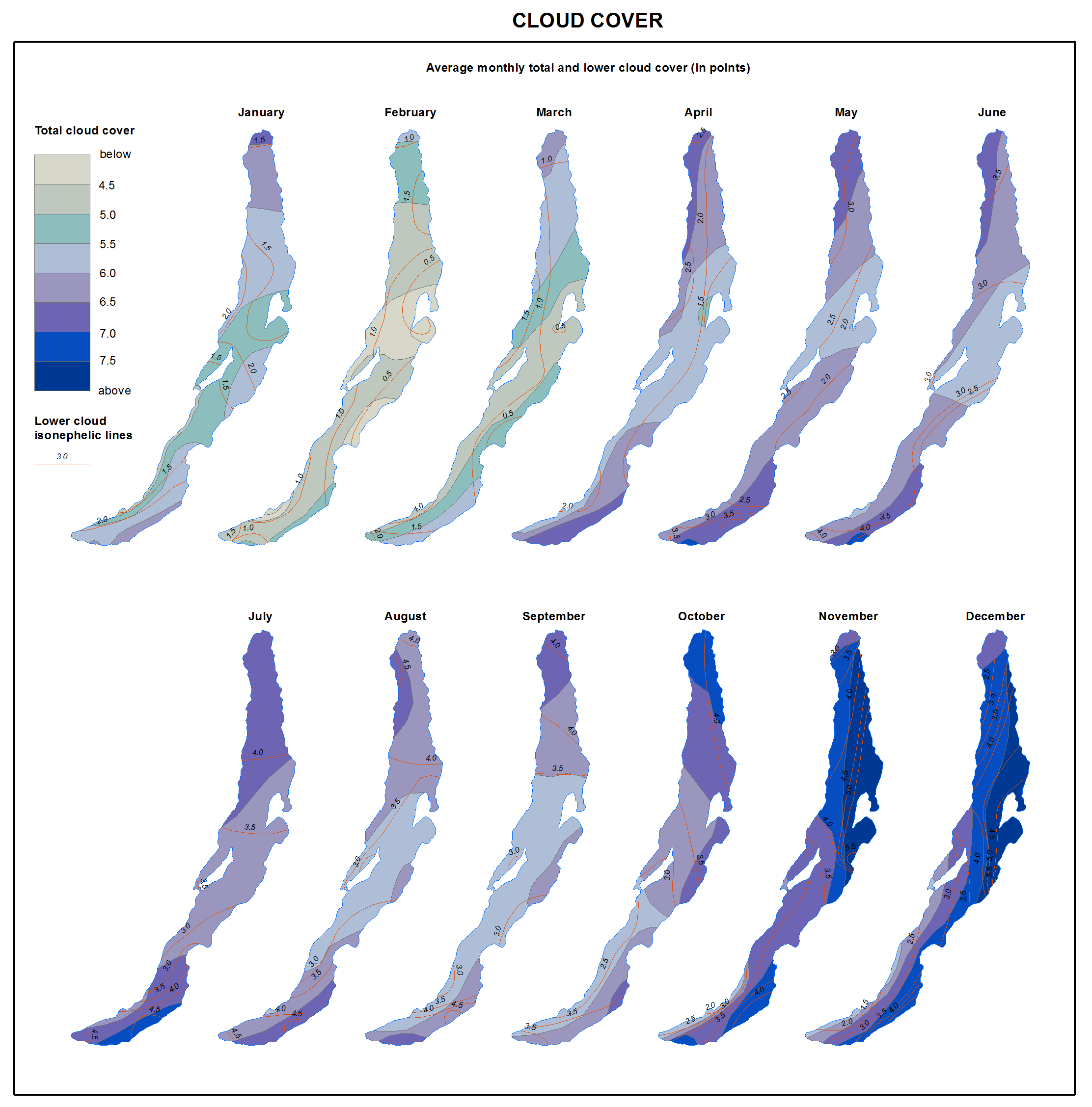
Cloud cover
Two maxima are recorded in the annual trend of cloud cover: summer (June-July) and pre-freeze-up (November-December). The latter prevails. The highest cloud cover values (7-8 oktas) and increased recurrence of overcast days (up to 75-80%) are registered in December on the north-eastern coast of the lake, whereas the lowest values (no higher than 4 oktas) are observed in February-March on the western shore, particularly within the territory of Maloye More (Small Sea). The foehn effect plays a significant role during the transfer of air masses over the Primorsky and Baikal Ridges, which causes a considerable drop of air humidity. In October-December, the cloud cover is very low above Lake Baikal due to the intense water evaporation from the ice free surface of the lake.
