BALTIC NUTRIENT GIS

The HELCOM Contracting Parties undertake to prevent and reduce pollution of the Baltic Sea area from land-based sources. To show the effectives of the actions, HELCOM collects reliable data on inputs of land-based sources. Such data are also required for evaluation of the state of the open sea and coastal waters.
HELCOM produces periodic pollution load compilations (PLCs) by compiling information on the waterborne inputs of important pollutants entering the Baltic Sea from different sources in the Baltic Sea catchment area. The latest compilation, the 4th Baltic Sea Pollution Load Compilation quantifies discharges and losses of nutrients and hazardous substances to inland surface waters and the resulting waterborne inputs to the sea in 2000. The Baltic Nutrient GIS convents this work into a geographic information system.
The Baltic Nutrient GIS includes also some data collected by other organs such as UNEP Grid Arendal, Tacis information Office (European Commission), Baltic Sea Research Institute - Warnemünde and the National Land Survey of Finland.
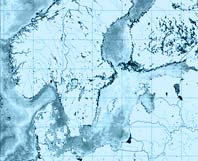
The Baltic Nutrient GIS can be used to view different datasets related to nutrients discharged from point sources and measured at river mouths as well as the area specific loads per sub-region over a common background map:
emissions of phosphorus and nitrogen from point sources
riverine loads of nitrogen and phosphorus
area specific loads of nitrogen and phosphorus
In addition, the atlas includes some necessary background datasets (coastlines, sea areas etc.), documentation of all the datasets and a tool to view these map datasets. The data is in WGS84 coordinate system and projected in ETRS_1989_LAEA.

