8. Responses to flood events - Country Reports
8.3 Responses to flood events in Viet Nam
The need for a coherent, long-term strategy for managing and mitigating floods occurred as a consequence of the 2000 flood. Some emergency measures have already been implemented, or are under implementation. Other structural measures are being examined, but require heavy investment and may sometimes be questionable in their long term impacts.
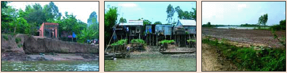
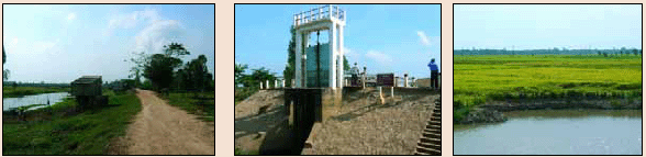
The security stake: People remember the dreadful flood of 2000. They are afraid that such a situation will happen again. They say they “want to live peacefully and safely with the flood". The security of people living in the area is a priority for the authorities and the institutions responsible. They have addressed the issue of housing located in risky areas for several years now. Families in risky areas are encouraged and supported to move to safer places. For that purpose new settlement areas have been built. Some are still in progress and some are planned. For example, in the Province of An Giang, the resettlement programme started in 2002. From 2002 to 2005, 37,058 households moved to 212 settlement areas totalling 816 ha with a total investment of roughly US$50 million. Non-structural measures have also been taken, such as promoting child safety, development of kindergartens which will watch young children during the flood periods or the provision of swimming lessons. The Annual Flood Report 2005 Team were told that presently, the number of children who die from drowning during a normal flood season is comparable to that in the dry season.
The security of people living in risky areas is a major concern. People are encouraged to move to safer locations where resettlement areas are being prepared.
The rice stake: The main revenue in the Mekong Delta, is the production of rice. The average production is close to 1,000 tonnes per inhabitant. In the Mekong Delta, in theory, three rice crops are possible (even up to seven crops every two years in the downstream areas). The first crop starts after the end of the flood period in December and is harvested in March. Pumping the water from the fields may be necessary to start this crop in time in the event of a long flooding period. The second crop starts in April, after the first rainfall and is expected to end when "early flood" starts, generally by end of July. Some irrigation may be necessary for starting this crop in time when there is not enough rainfall to fine tune harvesting before the early flood. The short cycle rice varieties are preferred. The third crop, starts in August and ends in November and is only possible in the highest lands or lands artificially and fully protected from flood.
Agricultural production is an essential source of revenue in the Mekong Delta. Rice is the major crop, and there is heavy pressure to fully protect the production from flood.
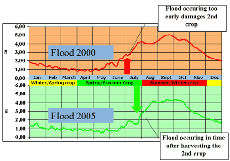
Figure 57: The relation of the flood to
the second rice crop.
In the Mekong Delta, a great majority of farmers (70%) have less than one hectare and often families have only 0.50 ha. This illustrates why in the lowest areas, priority is given to securing a second crop by building embankments which can retain the early flood. But in these low lands there is also great pressure to build fully protected areas enabling a third annual crop.
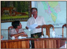
The Vice Chairman of the Peoples Committee of An Phu District, An Giang Province, explains: "Our first priority is to start the second crop as early as possible to be ready to harvest before the starting of the flood. Our objective is to raise and secure embankments so we can, at least, protect our fields against the early floods. The farmers put pressure on us to build "full flood" protection with concrete embankments so that even a third crop season could be undertaken nearly everywhere. We think that this is a very expensive solution, and one that is also questionable in terms of the environment and long term sustainability. So our objective is clearly to secure two crops but not the third one."
As an example, Figure 58 represents the percentage of land that has been cultivated with a third crop in 2005 in the province of Dong Thap (breakdown by district) . This includes both lands where a third crop is naturally possible, but also low lands which were flooded in the past and where embankments now bring enough protection. This indicator could be monitored in the future for identifying the areas of low lands that are sufficiently secured against flood.
_______________
5The map was drawn based on the GIS layers available at MRCS. It is based on former districts organisation and will require updating.
Choose a newsletter: