|
Traditionally, rainfall is recorded through a network of meteorological stations. These measurements are used to extrapolate rainfall patterns over long periods of time and over the entire Mekong region.
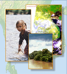
Although many parts of the Mekong basin receive ample rainfall during the Monsoon season, there is considerable variation in the spatial distribution, the intensity, and the amount of rainfall that is received on a weekly, seasonal or annual basis.
TRMM is scheduled to operate until the end of this decade. The data it sends back to Earth can fill many gaps in our understanding of rainfall and its variation, its intensity and its areal coverage. Furthermore, the critical onset of large annual circulation regimes, such as the Asian summer monsoon, can be more thoroughly observed and studies using monthly or yearly time series as well as near-real time precipitation maps that are distributed every three hours over the internet.
For more information, take a look at the Image of the Month section of Mekong from Space, or at the NASA website (http://trmm.gsfc.nasa.gov/).
Satellite data products complement and enhance conventional rainfall data collection. Since 1998, the Tropical Rainfall Measurement Mission (TRMM) has contributed an extraordinary amount of information on rainfall around the tropical world, including Southeast Asia.
|