|
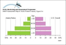
Age structure of Alaska indigenous, Alaska total, and United States total populations, 1980
|
|
|
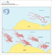
(a) Trajectories of five satellite-tracked buoys launched in Mackenzie Bay, Canada, and (b) results of 30-day trajectories of oil launched from five hypothetical spill locations in the Beaufort Sea
|
|
|
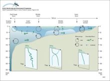
The different domains of the Bering Sea continental shelf are separated by fronts The coastal domain (depth <50m) tends to be vertically homogeneous, the middle domain (50-100m) shows a clear [..]
|
|
|
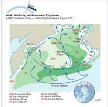
Schematic diagram of circulation and the extent of different water masses in the Bering Sea
|
|
