WHAT KIND OF TOOL IS IT?
The tool is a software program.
WHAT ARE THE DIFFERENT PARTS TO IT?
It is a single, stand-alone software program with supporting materials including instructions and example files.
WHAT DOES IT DO?
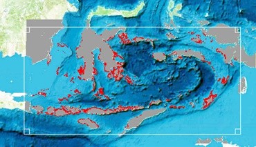
The tool simulates the dynamics of fish populations and fishery catch with a focus on the impact of MPAs. Although the tool has been designed primarily for education and training purposes, it can be used to support decision making on MPAs. It allows users to identify the best overall design of MPAs, including their total number, locations, and size, by taking into account fisher behaviour, local characteristics of the environment and connectivity between different areas through fish movements.
HOW DOES IT WORK?
The user can open a habitat map and planning units or use the program to calculate planning units. Environmental characteristics and the connectivity of different planning units can also be loaded or calculated by using the program’s internal functions (examples are provided along with the user manual). Multiple species can be added simultaneously. The user can then specify the intensity of fishing and any desirable MPA scenario to simulate the impact on both fish populations and fishery catch.
The first and most simple approach to design MPAs in the program is to choose locations manually and by visualising the connections of fish larvae among planning units. The user can then compare the efficacy of multiple MPA designs to obtain an intuitive feel for how MPA location impacts the fishery and the contents of the MPA.
Secondly, the user can ask the software to create an optimal MPA design. The user specifies the objectives of the MPA design (e.g. to maximise fisheries). They can add existing MPAs and identify the locations of priority fished areas to support. The software then selects sets of MPAs that meet the objectives.
Finally, the user can animate their results to see how MPA and fishery benefits change over time.
IN WHAT FORMAT IS IT AVAILABLE?
It is a software program available for installation as an executable file.
WHO IS THE TARGET END-USER?
- Policy makers
- Government and NGO planners undertaking MSP
- Researchers studying marine reserve design
WHAT USER SKILLS ARE REQUIRED?
Prior knowledge and expertise required to use the tools are minimal.
WHERE DO YOU ACCESS THE TOOL?
Download the tool using the links at the bottom of this page.
WHAT IS THE COST OF USING THE TOOL?
The tool is open-access and is available free of charge, under the user agreement and stated terms and conditions (see www.ccres.net/terms).
IS TECHNICAL TRAINING OR SUPPORT REQUIRED?
For best results, training in use of this tool is recommended.
For more information, contact Prof Peter Mumby.
Downloads:
You must be registered to download CCRES tools, please LOGIN or REGISTER NOW.