• DSF
Introduction
• System Components
• Using the System
• System Maintenance
Decision Support Framework
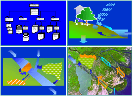
The DSF has been developed through a process of consultation involving all four National Mekong Committees and line agencies from each country. The system comprises three main elements accessed through a single user-interface:
- a Knowledge Base containing information on the historical and existing resources and, when fully populated, socio-economic and environmental conditions, as well as predictions of how these may change in the future
- a suite of Simulation Models that enable the prediction of impacts of changes in conditions within the basin on the river system, and
- a set of Impact Analysis Tools that enable the prediction of environmental and socio-economic impacts in response to changes in condition of the river system
Background Technical Reference Reports have been prepared
for each component of the system that record how each has
been developed and tested.
User Interface
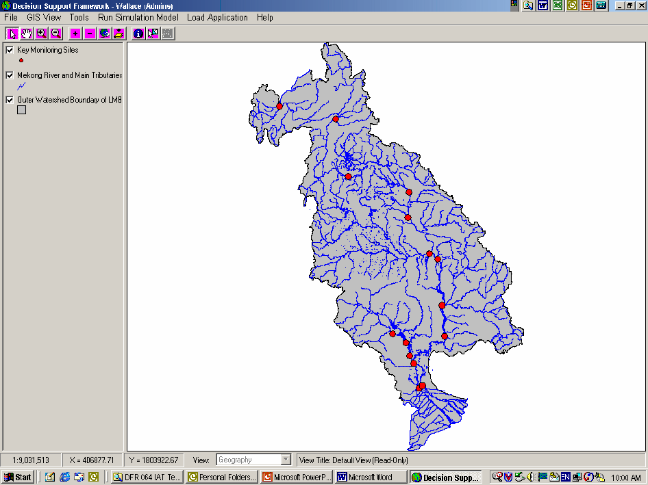
Access to the DSF is through the main interface, with menus to guide the user through the entire system (according to user access rights set by the Administrator). A context-sensitive Help function is provided with direct links to a suite of User Guides. The main user interface can be easily customised to provide user-defined views.
Knowledge Base
 The Knowledge Base contains the core data, pre-defined models
(new model configurations can be set up by the Specialist Modellers
and loaded into the Knowledge Base), selected outputs from the
model simulations and the results of analyses conducted with
the Impact Analysis Tools. The Knowledge Base is flexibly structured
to allow new information to be added.
The Knowledge Base contains the core data, pre-defined models
(new model configurations can be set up by the Specialist Modellers
and loaded into the Knowledge Base), selected outputs from the
model simulations and the results of analyses conducted with
the Impact Analysis Tools. The Knowledge Base is flexibly structured
to allow new information to be added.
Data held in the Knowledge Base are listed in the on-line data
catalogue. Meta data records the sources and status of all the
information held. The core data have been drawn principally
from the MRCS Databases, with some directly from individual
country sources. All KB data can be readily exported.
Hydrological Models
 Three basic types of model have been developed for the DSF.
A series of hydrological models, based on the SWAT software
of US Department of Agriculture, have been set up to simulate
catchment runoff based on estimates of daily rainfall and
the topography, soils and land cover of each sub-basin. The
SWAT software has the capability to investigate nutrient and
sediment flows also, but there are insufficient data to establish
calibrated models for these at present.
Three basic types of model have been developed for the DSF.
A series of hydrological models, based on the SWAT software
of US Department of Agriculture, have been set up to simulate
catchment runoff based on estimates of daily rainfall and
the topography, soils and land cover of each sub-basin. The
SWAT software has the capability to investigate nutrient and
sediment flows also, but there are insufficient data to establish
calibrated models for these at present.
Basin Simulation Models
 The hydrological models provide inputs to a series of basin
simulation models that are based on the IQQM software originally
developed for the Murray-Darling Basin in Australia. The simulation
models route catchment flows through the river system, making
allowance for control structures such as dams and irrigation
abstractions. Information on daily discharges are generated
throughout the system and particularly at the primary outfalls
of Kratie on the mainstream and the Great Lake in the Tonle
Sap basin. The IQQM software also draws from data in the Knowledge
Base to estimate irrigation demands throughout the LMB in
a consistent manner.
The hydrological models provide inputs to a series of basin
simulation models that are based on the IQQM software originally
developed for the Murray-Darling Basin in Australia. The simulation
models route catchment flows through the river system, making
allowance for control structures such as dams and irrigation
abstractions. Information on daily discharges are generated
throughout the system and particularly at the primary outfalls
of Kratie on the mainstream and the Great Lake in the Tonle
Sap basin. The IQQM software also draws from data in the Knowledge
Base to estimate irrigation demands throughout the LMB in
a consistent manner.
Hydrodynamic Models
 A hydrodynamic model, based on ISIS software, is used to simulate
the river system downstream of Kratie, including the Tonle
Sap and the East Vaico in Viet Nam where wet season flooding
extends beyond the LMB boundary. The hydrodynamic model represents
the complex interactions caused by tidal influences, flow
reversal in the Tonle Sap River and over-bank flow in the
flood season with the varying inflows from upstream. Typically
it generates hourly data for water levels and discharges throughout
the main channels and distributaries in the delta. A salinity
intrusion model has also been set up with the ISIS software
drawing on the results of the hydrodynamic model. ISIS also
has capability to simulate other water quality parameters,
including sedimentation, but at present there are insufficient
data to warrant setting up these models.
A hydrodynamic model, based on ISIS software, is used to simulate
the river system downstream of Kratie, including the Tonle
Sap and the East Vaico in Viet Nam where wet season flooding
extends beyond the LMB boundary. The hydrodynamic model represents
the complex interactions caused by tidal influences, flow
reversal in the Tonle Sap River and over-bank flow in the
flood season with the varying inflows from upstream. Typically
it generates hourly data for water levels and discharges throughout
the main channels and distributaries in the delta. A salinity
intrusion model has also been set up with the ISIS software
drawing on the results of the hydrodynamic model. ISIS also
has capability to simulate other water quality parameters,
including sedimentation, but at present there are insufficient
data to warrant setting up these models.
Each model is run from the DSF interface with data automatically
transferred from one to another through the Knowledge Base.
A number of adjustments to the models that do not involve
reconfiguring the model are also possible through the DSF
interface (such as varying demands and climate). Guidelines
for using the modelling software are provided in the software
manuals, and on operating the DSF interfaces in the DSF User
Guides.
Results from the model simulations are stored in the Knowledge
Base for further investigation using the suite of Impact Analysis
Tools.
Impact Analysis Tools
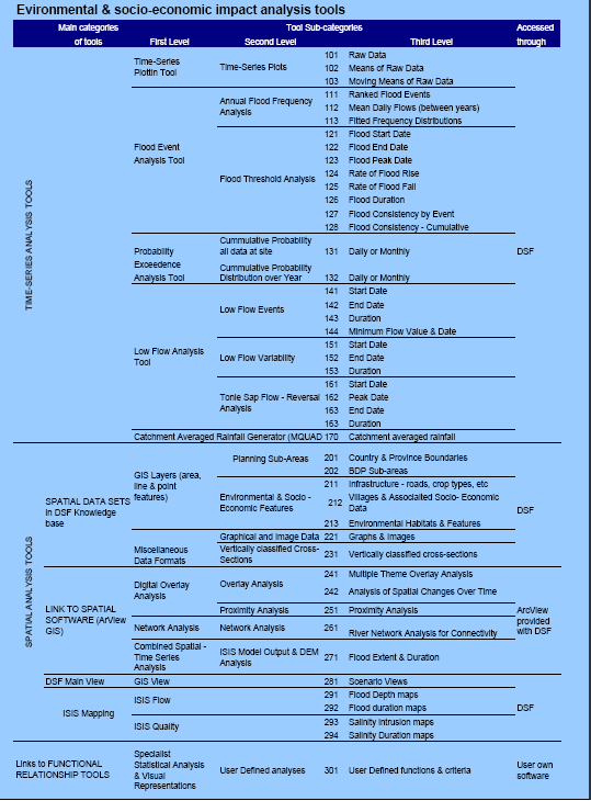
Guidance on when and which impact analyses tools to select and on their application is provided in separate reports.
Each tool has been specifically developed so that the full range of environmental and socio-economic indicators can be investigated.
In the case of the spatial analyses, information derived from the mapping tools can be overlain on any range of appropriately formatted spatial data using ArcView (provided with the DSF) to make direct assessments of impacted populations, land areas or sites of specific interest.
The basic models have been calibrated and the results are given in the Technical Reference Reports. These provide a clear indication of the confidence that can be expected in the projections made with the models. The DSF system has been tested and evaluated as a whole, and this is reported. A Hydro-Ecological Report provides good examples of how the DSF can be used to provide considerable insight into the characteristics and behaviour of the river basin.

E-Newsletters
Choose a newsletter: