


Document Actions
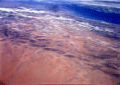
Background:North-Western Sahara Aquifer System
The Sahara and Sahel Observatory, an independent international organization based in Tunisia, is composed of African and European countries, regional and international organizations, and representatives of civil society.
The North-Western Sahara Aquifer System
refers to the superimposition of two thick aquifer layers:
- The Intercalary Continental (IC) formation, which is the thickest and has the greatest expanse, and
- The Terminal Complex (TC) which is heavily exploited in the Algero-Tunisian Chotts region and in the Gulf of Sirte in Libya.
The geological map of the north-western Sahara platform shows extensive outcrops of the Upper Cretaceous, which starts with the Cenomanian transgression. Directly underlying the Cenomanian clays, the formations of the Intercalary Continental [IC] reach to the edge of the platform, forming a continuous ring from El Goléa to the southern boundary of the Hamada El Hamra. To the northwest of the basin the IC crops out all along the Saharan Atlas, and to the northeast it crops out on the Dahar and the Jabal Nefussa. Further south, the IC directly overlies the Palaeozoic marine formations, which crop out in a continuous belt from the Moroccan border at the north-western edge of the basin to the town of Hun at its south-eastern tip. From outcrop observations we can define the Intercalary Continental as the continental group enclosed between the Hercynian folds, which drove the sea from the Saharan platform, and the marine incursion of the Upper Cretaceous. It consists mainly of continental argillaceous sandstone formations from the Lower Cretaceous.
This definition of the Continental Intercalary was used to set the boundaries of the North-Western Sahara Aquifer System study area, as follows: the Saharan Atlas to the northwest, the Ougarta Palaeozoic outcrops to the west, the Tassilis and the Jabal Hassaouna to the south, the edge of the brackish waters to the east of the Hun graben, the outcrops of the Intercalary Continental on the Jabal Nefussa and the Dahar to the northeast, and, last the South Atlas Fault to the north and on to the Gulf of Gabès through the El Hamma-Médenine Fault.
 IW:LEARN.net