More information and download links below the graphic.
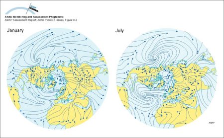
Arctic atmospheric circulation

Click here, or on the graphic, for full resolution.
The mean circulation of the lower atmosphere during January and July as depicted by mean streamlines of the resultant winds
| Sources | Wendland, W.M. and R.A. Bryson, 1981. Northern hemispheric airstream regions. Monthly Weather Rev. 109: 255-270. (AAR Figure 3.2) | ||||
|
Cartographer/ Designer |
Graphical production: Philippe Rekacewicz and Emmanuelle Bournay (GRID-Arendal) | ||||
| Appears in |
AMAP Assessment Report: Arctic Pollution Issues |
||||
| Published | 1998 | ||||
| Feedback/Comment/Inquiry | Contact webmaster | ||||
| Search for other graphics |
With related subjects Covering the same geographic area |
||||
|
Available Downloads
(please review use constraints above) |
|
||||
|
Citation/Reference Use constraints |
Please refer to the AMAP policy regarding use and reproduction of AMAP maps and graphics |
