Maps & Graphics Database

The AMAP Maps and Graphics Database contains 574 maps and graphics related to AMAP. Use the form below to search for data sets.

Please read the AMAP policy regarding use and reproduction of AMAP maps and graphics before using these graphics.

Thematic keywords

Get items from keywords: 


Free-text search


Random graphic of the day


Collective dose commitment from nuclear fuel reprocessing activities

Collective dose commitment from nuclear fuel reprocessing activities
From the AMAP Assessment Report: Arctic Pollution Issues collection.


There are currently 574 graphics available in the database, with the last update February 23, 2010.

Collections and reports

Graphics are grouped by collections, which represents the AMAP reports and publications which the graphics have been published in. See the collections page for more information.


Query by region

Map over regions for quick graphic searches Maps and graphics for Greenland Maps and graphics for Iceland Maps and graphics for Svalbard Maps and graphics for Arctic Ocean Maps and graphics for Alaska Maps and graphics for Norway Maps and graphics for Sweden Maps and graphics for Finland Maps and graphics for Canada Maps and graphics for Kola Peninsula Maps and graphics for Franz Josef Land Maps and graphics for Novaya Zemlya Maps and graphics for Barents Sea Maps and graphics for Bering Sea Maps and graphics for Kamchatka Maps and graphics for Russian Federation Maps and graphics for Europe Maps and graphics for North Atlantic Maps and graphics for North Sea Maps and graphics for North Pacific Maps and graphics for Circumpolar Arctic
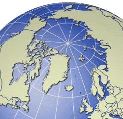
Selected regions and countries are available through clicking in the above map, other regions are the Circumpolar Arctic and Global, see the full list of regions for more.


Latest graphics

The newest additions to the database: