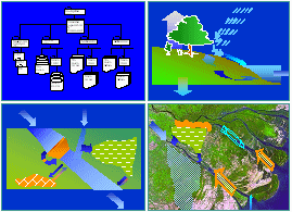
• DSF Introduction
• System Components
• Using the System
• System Maintenance
Decision Support Framework
The changing nature of the Mekong River Basin
The Mekong River rises in China and flows 4,800 km to the South China Sea in Viet Nam. En route tributaries flow into the mainstream from Myanmar, Lao PDR, Thailand, Cambodia and the highlands of Viet Nam. In its upper reaches the course of the river is incised within the landscape, turning to a braided channel in its middle reaches before flowing out on to the vast flood plains in Cambodia and Viet Nam. A unique feature of the river is the annual cycle of flow into and out of the Tonle Sap Great Lake, created by the rise and fall of the flows in the mainstream.
Although the mainstream within the Lower Basin remains undeveloped, China is developing hydropower dams in the Upper Basin on the mainstream and a large number of small and medium-sized dams have been built on the tributaries mainly for irrigation and power generation purposes. The delta has been intensively developed for agricultural and brackish water aquaculture production. Freshwater fisheries remain an extremely important asset within the basin, particularly in the Great Lake. Navigation and tourism are also important uses of the river system.
Examples of interventions that can be
investigated with the DSF
• Land use/ land coverage changes• Climate and sea level changes
• Water supply demands
• Aquaculture development
• Irrigation abstractions
• Revised crop patterns
• Changes in existing dam operation
• New dams and reservoirs in LMB
• China dam cascade
• In-stream regulation
• Inter-basin diversions
• River improvement works
• Flood works in floodplain/tributaries
• Salinity intrusion barriers
Nearly 60 million people live in the LMB, with population densities highest in the delta. For many the river system provides an essential foundation to their economic and social well being, and sustains the natural environment upon which their lives and culture depend.
Continued change is inevitable, however. This will be brought about by economic and social pressures as populations grow and expectations rise, by Governments’ and private enterprise’s recognition of development opportunities to improve people’s livelihoods, and by externalities such as varying patterns of rainfall and sea level rise due to climate change. Each is likely to impact directly or indirectly on the water resource system and consequently upon the riverine environment and people’s livelihoods
Purpose of the DSF
The DSF has been set up to assist planners to assess both the magnitude of changes brought about through natural and man-made interventions in the water resource system, as well as the impacts that these will have on the natural environment and upon people’s livelihoods.
The DSF achieves this by being able to model the behaviour of the river system under a wide range of different interventions. The DSF also provides a set of analytical tools by which to assess how these will affect key environmental and social indicators.
Transboundary environmental issues
| MRC Agreement Article 6 ‘ Rules’ | River Bank Erosion | |||
| “Acceptable” minimum
low flows for each month of the dry season “Acceptable” natural reverse flow of the Tonle Sap in wet season Average daily peak flows < average natural flood season conditions |
Accelerated, progressive river bank erosion Destruction of valuable urban/industrial and agricultural land & infrastructure |
|||
| Obstruction to Navigation | ||||
| Water Quality Deterioration & Sedimentation | Obstruction of river navigation Reduced dry season flows or rapidly fluctuating river levels River channel and estuarine sedimentation |
|||
| Eutrophic conditions Elevation of suspended sediment levels Elevated levels of microbial pollution Pesticide pollution Elevated salinity levels upstream of the delta Water quality changes caused by stratification Acidification of surface waters and wetlandsIncreased saline instrusion in the delta |
||||
| Inadequate Dry Season Flows | ||||
| Altered catchment runoff Dam storage/relase operations, or inter-basin transfers Water Availability Critical habitats Aggregate area under dry season irrigation |
||||
| Fisheries Productivity & Ecosystem Functioning | Flooding | |||
| Reduced, elevated or smoothed dry season flow regime
changes Wet season flood flows and flooded areaAdequate Tonle Sap seasonal flow reversal Increased fishing pressure Connectivity for fish migration / dispersal Impact of elevated suspended sediment levels Pesticide pollution Elevated salinity levels –upstream of the delta Cold and/or deoxygenated water releases Soil acidification and associated increases in surface water acidity levels Decreased brackish zone area |
Altered catchment runoff Dam storage/ release operations, or inter-basin transfers Flood mitigation works Loss of life and increased incidence of water-related diseases Destruction and damage to infrastructure Disruption to the use of community infrastructure during flooding Loss of agricultural production Reduced flooding in important habitatsExtend and duration of flooding |
|||
Possible Socio-Economic Indicators
Economic production
• Hydropower energy production *
• Fresh and brackish water fisheries production
• Agricultural production on flood plains
• Irrigated agricultural production *
• Navigation and related in-stream uses
Social and livelihoods
| • Health • Employment
|
- Access to water supply - Food security - Jobs in agriculture - Jobs in freshwater fisheries - Jobs in brackish water fisheries - As all above |
* Production is directly measured by the simulation models
The models are set up to run simulations over a number of years (hydrological data for 1985-2000 are available throughout the LMB) or for a single year or season.
Multi-year analysis enables statistical comparison of impacts to see, for instance, what happens on average, or for risk assessment over a sequence of wet or dry periods. Simulation of a single year or season enables planners to look at what would happen in typical or extreme years.
Potentially, a very wide range of socio-economic and environmental indicators can be assessed. The DSF has been developed in a generic format that allows analyses to be conducted both on impact data already loaded into the database and on new data as they become available in the future.
The final choice of socio-economic issues will depend on how the planners wish to structure their analyses. This will depend to a large extent on the data they are able to assemble.
Environmental indicators have been identified in relation to the transboundary issues identified by the four countries.
The six main issues have been sub-divided into 36 sub-issues and relevant water flow and water quality indicators identified for each.

E-Newsletters
Choose a newsletter: