|
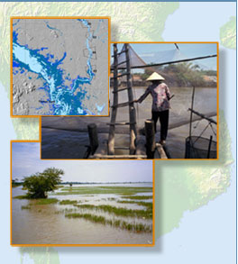
Because of their frequent revisit capability, satellite imagery can provide useful flood information at various stages of the monsoon season. Satellite sensors can furnish both detailed pictures of the local and regional flooding situations as well as wide area coverage of the entire basin.
Satellite sensors such as MODIS lend themselves for monitoring the entire Mekong basin on a daily basis, albeit at moderate spatial detail, cloud cover permitting.
Radar images are especially useful during the monsoon season, as they can "see" flooded areas in some detail by penetrating even dense cloud cover. Mapping the extent of consecutive floods by means of radar image analysis and superimposing the resulting maps into a single map can yield a useful visual aid to assess the spatial variability of the monsoon floods from year to year.
|