|
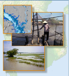
The Mekong River is the major lifeline in mainland Southeast Asia. Its numerous tributaries, lakes and wetlands add to an aquatic ecosystem of enormous geographical proportion. Satellite imagery is used to study, map and monitor the dynamic pulse and the environmental change that is experienced by rivers, lakes and wetlands with the annual passing of wet and dry season.
|