|
SCS Geographical Information System |
|
Written by Christopher John Paterson
|
|
Monday, 16 January 2006 |
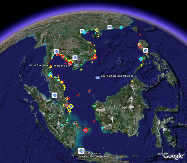
The South China Sea Geographical Information System 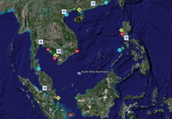 The UNEP/GEF South China Sea Project Geographical Information System (SCS GIS) was developed to facilitate the online sharing and update of information and data for coastal habitat sites in and bordering the South China Sea. It is anticipated that this GIS will be built upon during the implementation of the revised Strategic Action Programme for the South China Sea from 2009-2013. The UNEP/GEF South China Sea Project Geographical Information System (SCS GIS) was developed to facilitate the online sharing and update of information and data for coastal habitat sites in and bordering the South China Sea. It is anticipated that this GIS will be built upon during the implementation of the revised Strategic Action Programme for the South China Sea from 2009-2013.
The SCS GIS contains information and data for the project’s network of habitat demonstration sites and more than 135 habitat sites characterised during the South China Sea Project. Users can access data for mangrove, coral reef, seagrass, and wetland sites by following the main links on the GIS page and by clicking on site icons to display data rich information bubbles.
A key feature of the SCS GIS is that data for all existing and new sites can be submitted to the GIS via the GIS Update Page Following review and approval by regional experts this data will be available automatically via the GIS page. This user-friendly update procedure is based on the Google Earth interactive mapping system.
A full layer for the South China Sea Project can be viewed on Google Earth by visiting the Google Outreach Showcase or by loading directly in Google Earth by clicking here. Please contact the Project Coordinating Unit for any further information.
|
|
Last Updated ( Monday, 08 September 2008 )
|