|
South China Sea Project on Google Earth |
|
Written by Chris Paterson
|
|
Saturday, 01 December 2007 |
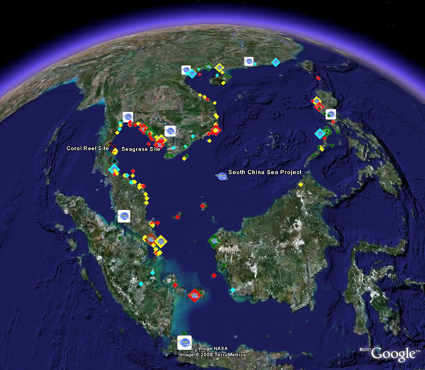
UNEP/GEF South China Sea Project on Google EarthThe wide range of outputs and information generated through the UNEP/GEF South China Sea Project can now be explored on Google Earth. In order to use this new feature of UNEPSCS.org, you must first install Google Earth. Click here to download Google Earth. The South China Sea Project layer on Google Earth features the project’s institutional network, suite of habitat demonstration sites, and a large number of site characterisations for coastal habitat areas in the South China Sea and Gulf of Thailand. The layer is linked to all related documents and databases on UNEPSCS.org. Click here to view the South China Sea Project on Google Earth. The layer can also be accessed via the Google Earth Outreach Showcase. Google Earth’s Outreach Programme provides a variety of templates and instructional guides on how to best make use of Google Earth for extending information about the work of your organisation or project to the global community of Google Earth users. Click here to learn more about Google Earth Outreach. Figure 1. A screenshot of the UNEP/GEF South China Sea Project Layer on Google Earth |
|
|
Last Updated ( Sunday, 24 February 2008 )
|