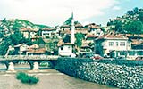
Bosnia-Herzegovina
Landscape, climate and water flow
The central part of Bosnia and Herzegovina is mountainous with peaks ranging from 500 to 2,000 metres above sea level. The watercourses belonging to the Danube River Basin in Bosnia and Herzegovina – the Sava and its tributaries – are located at the lowest part of the country, ranging from less than 200 metres above sea level at the lower tributaries, to 500 metres at the upper tributaries.
The Sava River runs 345 km in Bosnia and Herzegovina, from Croatia at the mouth of the Una River and leaving at the Drina River mouth. The main watercourses that make up the Sava
Did you know?
A large part of the watercourses in Bosnia and Herzegovina are international waterways – the Sava forms the country’s border in the north, the Una partly makes its western border, and the Drina mostly makes up the country’s eastern border.
River Sub-basin – and thus the Danube River Basin District in Bosnia and Herzegovina – are the Una, Vrbas, Bosna and Drina River.
The mountainous, central part of the country is characterized by continental and mountain climate of Alpine type with severe winters in which temperatures drop to between -24 °C to -34 °C. The average rainfall in this area ranges from 1,000 to 1,200 l/m² – the highest quantities fall in November, and the lowest in February. Snowfall is also abundant, especially on higher elevations. The whole territory north of the central mountains has a moderate-continental climate with rather severe winters and warm summers. The average annual precipitation is lower than in the central part – ranging from 800-1,100 l/m².
Natural highlights
The wetland and pond ecosystems of Bardača are located on the left bank of the Vrbas River immediately before it joins the Sava River. The Bardača complex covers 3,400 ha and belongs to an alluvial plain created of sediments of the Vrbas and Sava Rivers. The Bardača complex is a unique wetland-swamp system. Bardača has a high level of biodiversity; aquatic plants and dense vegetation provide habitats for 178 bird species.
Human uses
There are 12 hydropower plants in the Sava River Sub-basin, all located on tributaries. Many plants are shared with neighbouring countries, as the rivers form natural borders between the countries. Also, nearly the entire length of the Sava River in Bosnia and Herzegovina is used for navigation, although it has not been identified as an international navigation course.
Pollution
Today, none of Bosnia and Herzegovina’s settlements with over 10,000 ES has a treatment facility for wastewaters, which means that all settlements over this size are also significant sources of pollution.
All watercourses should reach ‘Good Ecological Status’ by 2015 with the exception of the four water bodies on the Bosna River. All bodies under pressure were classified as ‘Exposed to risk in the first approximation’. The insufficiency of such an approach was due to the inadequate connection between the pressures and impacts, in terms of quantity of water, sum loads of several less significant pressures in the water body which exceed the threshold of a significant pressure, and upstream pressures (according to data from before 1990).
Of 22 groundwater bodies, 6 are considered to be ‘at risk’ due to human intervention, 4 are at risk of both quantity (due to over extraction) and quality, while the rest are threatened with quality risk only. Four groundwater bodies have insufficient data to estimate status.
For detailed information on the above, download the fact sheet below.
Disclaimer
The information contained in the ICPDR website is intended to enhance public access to information about the ICPDR and the Danube River. The information is correct to the best of the knowledge of the ICPDR Secretariat. If errors are brought to our attention we will try to correct them.
The ICPDR, expert group members, nor other parties involved in preparation of information contained on this website cannot, however, be held responsible for the correctness and validity of the data and information provided, nor accept responsibility or liability for damages or losses arising directly or indirectly from the use of the information conveyed therein.
Only those documents clearly marked ICPDR documents reflect the position of the ICPDR.
Any links to other websites are provided for your convenience only. The ICPDR does not accept any responsibility for the accuracy, availability, or appropriateness to the user's purposes, of any information or services on any other website.
When using the information and material provided on this website, credit should be given to the ICPDR.