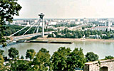
Slovakia
Slovakia’s Landscape, climate and water flow
While a major part of the Slovak territory is located in the Carpathian Mountains, almost one quarter of the country is formed by lowlands. The Vienna Basin extends into Slovakia from the west, the Pannonian Plain from the southwest and the Great Danubian Basin from the southeast. These lowlands form part of the ecological region known as the Hungarian lowlands. The climate of Slovakia is influenced by its location in a temperate zone. There are several types of climate regions within the country – from cold mountain (along the upper Váh River) to warm dry regions with moderate winters and more sunlight in the south.
Streams rising in Slovakia have relatively unstable discharges. High discharges occur periodically in spring months from March to April; with low discharges in summer and autumn. Slovakia’s borders overlap several hydrologic areas, giving rise to problems of assessing water flow in and out of the country. Several rivers with high water-bearing capacity have an eccentric influence on the country, especially the Danube River flowing from Austria, the Tisza River flowing from Ukraine and the Morava River flowing from the Czech Republic. The average discharge of Slovak Rivers is 3,328 m³.s-1, of which only 398 m³.s-1 (12 %) rise in the country.
Hydropower plants provide almost 30% of the present energy production in the Slovak Republic.
Natural highlights include:
The Danube Floodplains – from Bratislava to Klizská; the Morava Floodplains – a well-developed complex of diverse wetlands; the Latorica Floodplain area – housing many threatened and rare aquatic and swamp species; and a 6 km stretch of the Tisza River – shared with Hungary and Ukraine and containing rare examples of natural and near-natural wetland types.
Human uses
Some 2,825 settlements are situated in the Slovak share of the Danube River Basin District with over 5 million inhabitants. In urban areas, most of the larger rivers are modified for flood protection. On larger rivers with catchments above 1,000km², the most radical regulations are seen on the Uh and Latorica Rivers and on the Morava, which is 100% regulated. The hydropower potential of several rivers is used for energy production, including the Danube, Váh, Hornád and the Ondava. Half of the land in the Danube River Basin District of the Slovak Republic is used for agriculture.
Pollution
Rivers in the Slovak Republic receive insufficiently treated wastewater from agglomerations, industry and agriculture. Smaller waters are often influenced by diffuse pollution from households in settlements which are not connected to public sewage systems. In 2005, only 57.1% of the population was connected to sewage systems.
Of the 1659 surface water bodies identified in the Slovak part of the Danube River Basin District, 817 were classified as ‘at risk’ of failing to reach ‘good ecological status’ by the year 2015, 505 were classified as ‘possibly at risk’ and 343 were ‘not at risk’. Of the 96 groundwater bodies identified in the Slovak part of the Danube River Basin District, 7 are considered ‘at risk’ of failing to reach ‘good chemical status’ due to point source pollution and 16 due to diffuse pollution. All 23 water bodies identified as lakes are heavily modified water bodies. Due to groundwater abstractions, nine groundwater bodies are ‘at risk’ of failing to reach ‘good quantitative status’
For detailed information on the above, download the fact sheet below.
Disclaimer
The information contained in the ICPDR website is intended to enhance public access to information about the ICPDR and the Danube River. The information is correct to the best of the knowledge of the ICPDR Secretariat. If errors are brought to our attention we will try to correct them.
The ICPDR, expert group members, nor other parties involved in preparation of information contained on this website cannot, however, be held responsible for the correctness and validity of the data and information provided, nor accept responsibility or liability for damages or losses arising directly or indirectly from the use of the information conveyed therein.
Only those documents clearly marked ICPDR documents reflect the position of the ICPDR.
Any links to other websites are provided for your convenience only. The ICPDR does not accept any responsibility for the accuracy, availability, or appropriateness to the user's purposes, of any information or services on any other website.
When using the information and material provided on this website, credit should be given to the ICPDR.