
Looking into the future of the Black Sea
A new monitoring and assessment project will store, analyse, visualise and disseminate information on past, present and future states of the Black Sea Basin to assess and predict its sustainability and vulnerability.
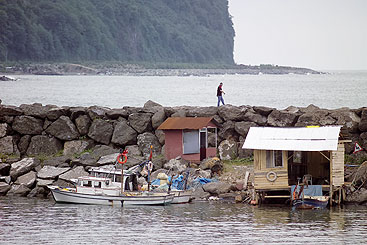
The Black Sea’s catchment area is large, with a total surface of around 2 million sq km, five times the surface of the Black Sea itself. The environmental vulnerability of the Black Sea region is well known, and the new system will assist countries to make decisions on the region’s future.
The Black Sea is the world’s most isolated sea – connected to the oceans via the Mediterranean Sea through the Bosphorus, Dardanelle and Gibraltar straits, and linked with the Sea of Azov in the northeast through the Kerch Strait. The Black Sea also suffers from severe environmental, social and economic problems. The new enviroGRIDS project addresses these issues by bringing to the region several emerging information technologies that are revolutionising the way we observe our planet.
The state-of-the-art enviroGRIDS project will assist
governments to monitor and assess environmental
trends in the Black Sea catchment. Launched in April,
the project answers a call by the European Commission
for capacity building for the development of the
Global Earth Observation System of Systems
(GEOSS), which links existing and planned
observation systems around the world, allowing
decision makers to access an extraordinary
range of information.
Analysing and visualising environmental trends. The system will be looking at the entire catchment area, and technical partners will use a hydrology tool called the Soil and Water Assessment Tool, a complementary tool to the MONERIS system used by the ICPDR. “The idea is not to replace the existing tools,” says Anthony Lehmann, Project Coordinator for enviroGRIDS, “but we will be able to compare and hopefully bring some new information to what you already have in the Danube.”
A gap analysis on earth observation systems in the region will identify specific areas where the majority of efforts are needed. The ICPDR, as one of enviroGRIDS partners, will perform and supervise the analysis, and recommendations from the analysis should complement the existing geographical information systems of the ICPDR.
To achieve its task, enviroGRIDS will take advantage of the most powerful computer network in the world, a computer grid assembled by the European Organisation for Nuclear Research (CERN), one of enviro-GRIDS’ partners. This grid will become one of the integral systems of GEOSS.
Building sustainable development in the region. In addition to modelling the catchment and contributing to GEOSS, the third main axis of the project is capacity building. The project aims to build significant local, national and regional capacity on observation systems to better exchange knowledge and information. As partners, the ICDPR and the Black Sea Commission (BSC) will help involve decision and policy-makers and disseminate project results. “An important part of the process was to get the ICPDR and the BSC involved,” says Lehmann. “The ICPDR has a welldeveloped network of communication and rather than build something new, it makes sense to use existing prominent institutions.”
In addition, the know-how and results will be made
available outside the Black Sea Basin. “The ICPDR and
its experience can serve as a model for how catchments
are monitored and modelled,” says Lehmann. “The
ICPDR is the best example in the region for other big
rivers to follow.”
Disclaimer
The information contained in the ICPDR website is intended to enhance public access to information about the ICPDR and the Danube River. The information is correct to the best of the knowledge of the ICPDR Secretariat. If errors are brought to our attention we will try to correct them.
The ICPDR, expert group members, nor other parties involved in preparation of information contained on this website cannot, however, be held responsible for the correctness and validity of the data and information provided, nor accept responsibility or liability for damages or losses arising directly or indirectly from the use of the information conveyed therein.
Only those documents clearly marked ICPDR documents reflect the position of the ICPDR.
Any links to other websites are provided for your convenience only. The ICPDR does not accept any responsibility for the accuracy, availability, or appropriateness to the user's purposes, of any information or services on any other website.
When using the information and material provided on this website, credit should be given to the ICPDR.