Romania
The Danube is of huge significance to Romania: covering 237,391 km² and with nearly 22 million inhabitants, the country is almost entirely within the Danube Basin. The Romanian section covers almost a third of the surface area of the Basin, and over a third of the river’s length flows through the country. Crucially, the Romanian (and also Ukrainian) Danube is the end carrier of all wastewater discharges from all countries into the Black Sea. Over half of Romania’s water bodies show high ecological status, however water quality in much of the remainder was significantly affected by development in the 1960’s-80’s.
Landscape, Climate and Water Flow
With 97.4% of Romania situated within the Basin, the Danube has played a major role in shaping the country. Romania’s relief is split threefold: 31% mountainous; 36% hills/plateaus; 33% plains; and is arranged in a ring and amphitheatre structure. The Carpathian ring is part of the Alpine chain, connected to the Alps in the west and the Balkans in the south. Beyond this and Transylvanian Depression which skirts it, are hills, tablelands and the Dobrogea Plateau, plus the plains of the Lower Danube and Banat–Crisana. Romania’s climate is mild, temperate-continental with four distinct seasons, most precipitation in the warm season and some Mediterranean influence to the south. Mean annual precipitation is 400-800mm in the main agricultural area and over 1200mm in the Carpathians. Severe drought occurs every 15–25 years. Romania is poor in water resources, with 1700 m³/inhabitant/year, ranking it 13th in Europe. Specific mean flow is under 1 l/s.sq.km on the Romanian, Dobrogea, Timis and Arad Plains and 40 l/s.sq.km in the high zones of the Fagaras and Retezat mountains. The river network comprises 78,905 km. Regarding only sites where the status of the water resource is a key factor, 6.1% of Romania (14,437.3 km²) has been designated for the protection of habitats/species.
Did you know?
The Danube River Protection Convention (signed in Sofia in 1994) was developed from a Romanian government initiative dating from 1985 (the Bucharest Declaration).
Natural highlights include the Danube Delta (UNESCO Biosphere Reserve, Ramsar and World Heritage site) – Romania’s most important protected area, covering 4178 km² and home to 5200 species; the Iron Gates Natural Park - one of the most beautiful natural areas of Europe with a vast biological diversity (SW Romania on the border with Serbia and Montenegro); Retezat National Park - a spectacular landscape of natural forests, alpine meadows, mountain peaks, gorges and glacial lakes, supporting 1190+ plant species (Southern Carpathians).
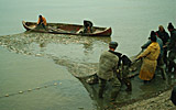
Human uses
Romania has considerable land resources; 62% of which are agricultural, 27% forest, 3.7% waters and 6.9% other uses (2000 data). Share of agricultural and arable land per capita is significant at 0.6 and 0.4ha respectively and is unevenly spread, with the highest proportion in the plains (80+% agricultural). Major cities are Bucharest (1,929,615 residents), Constanta (Black Sea port), Iasi, Timisoara, Cluj-Napoca, Brasov, Craiova, Ploiesti and the Danube ports of Galati and Braila.
Romania’s water resources comprise the Danube (44%), inland rivers (46%) and groundwater (10%). In 2005, 7.8 billion m3 was abstracted for human use. River systems are utilised for: hydroelectric power (29% of the country’s power supply); navigation; effluent receiving waters and the majority of Romania’s drinking water supply. Flooding is a problem, exacerbated by heavy localised rainfall, increased urban land use, ad hoc floodplain development, reduced river bed capacity and non-rational deforestation of large areas. Hydro-morphological pressures affect a large proportion of watercourses. Significant pressures come from reservoirs (255 in number); embankments (80% of the Danube is embanked); regulation works (6600km); water diversions; 138 significant water abstractions and 147 significant water restitutions.
Pollution
57% of Romanian water bodies, particularly those from mountainous areas, remain undisturbed by major anthropogenic pressure. However economic development between 1960 and 1989 resulted in a significant worsening of the water quality of the Danube and inland rivers. This has since improved (due to reduced development and new regulations) but remains inferior to the 1950s. Of the 2609 settlements with 2000+ people equivalents (p.e.), 17% have sewage systems; 263 settlements of 10,000+ p.e require systems with nutrient removal. 51.1% of the population is linked to wastewater collecting systems and 27.3% to treatment plants. However in rural areas, only 4.1% is connected to sewerage systems - rural wastewater management is the major challenge for the coming years. Navigation poses a significant pressure on the Danube: of 455 incidents involving shipping reported 1983-2003, 30 resulted in serious water pollution.
Regarding point source discharges, 359 significant pollutions have been identified at the basin level, accounting for 80% of total discharges recorded. In 2004, 13,034 tonnes of nitrogen (N) and 3399 tonnes of phosphorus (P) were released, 98% and 85% of which respectively derive from settlements. Agro-chemical fertilisers are the main source of diffuse discharges. With regard to Priority substances, 582 industrial units have been inventoried as discharging dangerous substances into water resources /sewage systems (2001 data).
The status of the Danube River, Delta and Romania’s coastal waters depends considerably on pollutant inputs from upstream countries (particularly for N and P loads). Diffuse agricultural sources, especially chemical fertilizer use in upstream countries and the improper working of wastewater treatment plants in Central and Eastern Europe is a major input.
For more detailed information and statistics on the above (including impacts of pollution and hydro-morphological alterations to the Danube system and mitigation measures), download the fact sheet below.
Disclaimer
The information contained in the ICPDR website is intended to enhance public access to information about the ICPDR and the Danube River. The information is correct to the best of the knowledge of the ICPDR Secretariat. If errors are brought to our attention we will try to correct them.
The ICPDR, expert group members, nor other parties involved in preparation of information contained on this website cannot, however, be held responsible for the correctness and validity of the data and information provided, nor accept responsibility or liability for damages or losses arising directly or indirectly from the use of the information conveyed therein.
Only those documents clearly marked ICPDR documents reflect the position of the ICPDR.
Any links to other websites are provided for your convenience only. The ICPDR does not accept any responsibility for the accuracy, availability, or appropriateness to the user's purposes, of any information or services on any other website.
When using the information and material provided on this website, credit should be given to the ICPDR.